


The main objective of this STSM was to better understand the onshore-offshore connection of a karst groundwater system in Antalya (Turkey), to engage with local groundwater agencies and to spread awareness of offshore freshened groundwater resources. During my STSM, I was able to test and implement new geophysical techniques to determine coastal aquifer thicknesses of a karst groundwater aquifer and to collect oceanographic data of a submarine groundwater discharge site. Additionally, I was able to establish collaborations, not only with my host institution (the İstanbul Technical University), but more importantly with the local and national water agencies as well as with the Marine and Coastal Management Authority of Antalya.
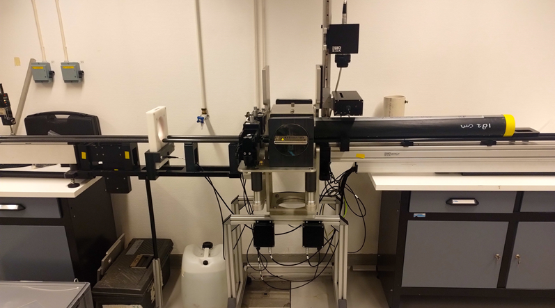
To determine the thickness of the aquifer system in the city of Antalya we deployed nine geophones to collect ambient noise passive seismic data. The geophones were deployed at different distances to one another to determine surface wave velocities at different frequencies. In total we measured at 8 different stations. Two of the stations were placed right next to existing boreholes to correlate our measurements to well logs. The other 6 stations are located next to existing geoelectric and transient electromagnetic data. The data reveals the thickness of the aquifer unit as well as soil thickness on top of the aquifer and will help to calibrate existing geoelectric and transient electromagnetic data. Although not all data acquired is processed and evaluated, the first results and the data provided from the authorities look very promising. Using the eight ambient noise seismic stations I will be able to create a thickness distribution map of the coastal aquifer. They will also help to verify and complement existing transient electromagnetic and geoelectric data.
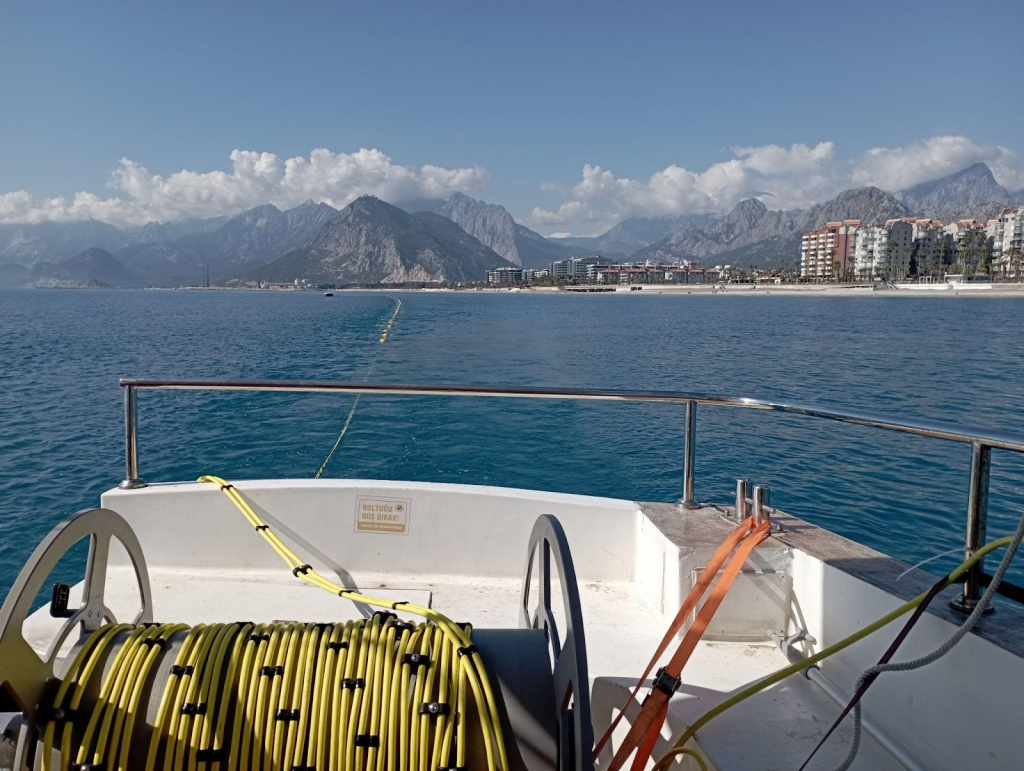
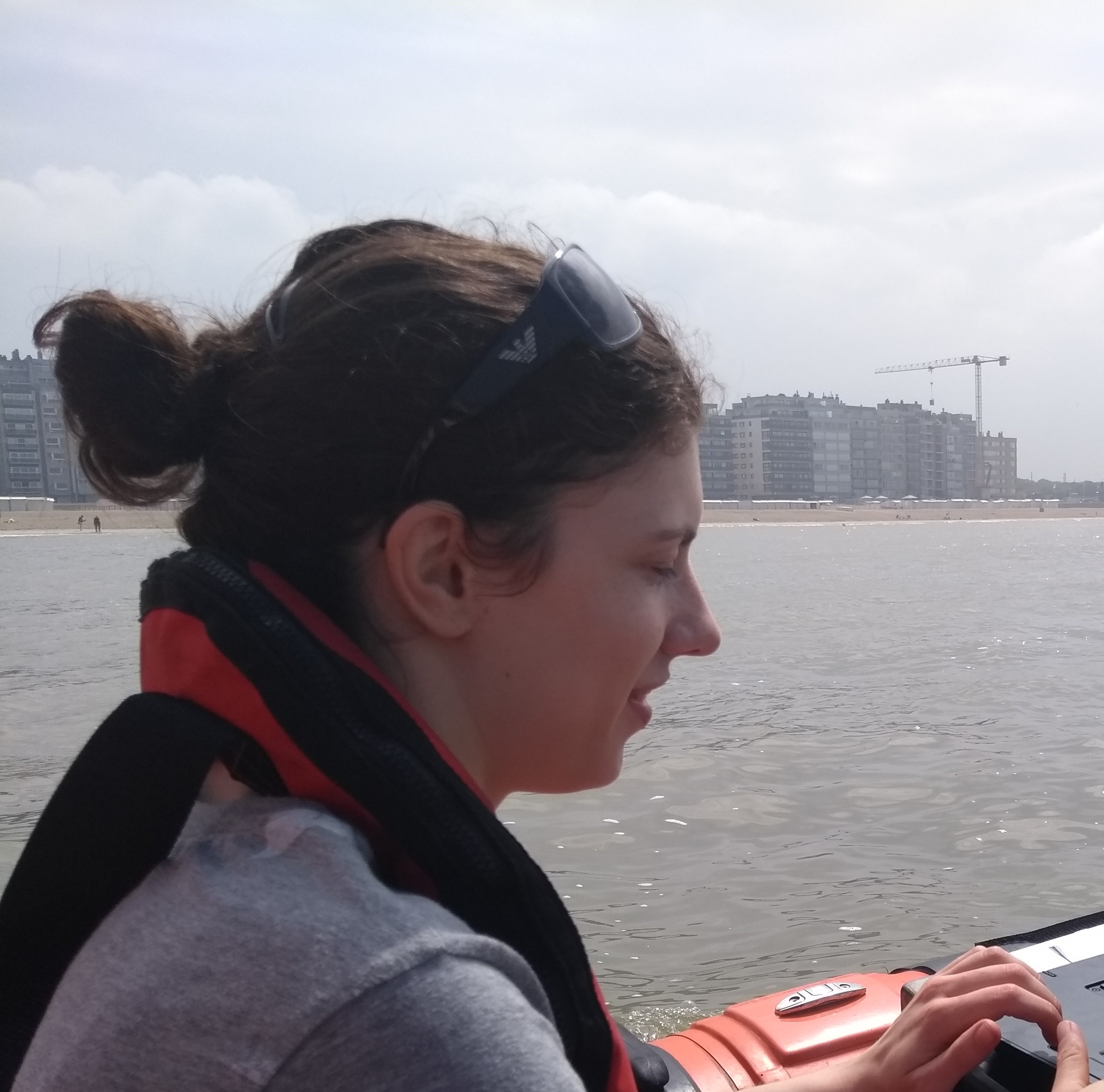
Deployment of the geophones behind the vessel
To better constrain the offshore aquifer and volumes of discharging meteoric waters from the seafloor we deployed a CTD and acquired video transects across the seafloor. This material revealed specific regions where outcrops of the karst aquifer on the seafloor indicate submarine groundwater discharge. With the help of a vessel from the Star Diving Academy, we managed to groudtruth hydroacoustic data and verify a distinct change in seafloor morphology and substrate in a region where we expect submarine groundwater discharge from the offshore aquifer. Video transects of the seafloor show outcropping rocks in the location of interest and will now be used to further constrain future sampling campaigns. The acquired CTD data will be used to guide the inversion of offshore geoelectric data to subsequently estimate a freshwater outflow from the seafloor.
During the STSM I was able to present and disseminate the results of a previous research cruise focussing on the offshore groundwater system in Antalya to different stakeholders. The results were presented first at the İstanbul Technical University, at the Antalya Municipality for Marine and Coastal Management and at the local water agency “ASAT” and finally at the National Water Agency “DSI”. The presentations resulted in fruitful discussions on offshore groundwater occurrences in Antalya and further geochemical and oceanographic data collections are planned. I was able to spread awareness for OFG in Antalya and the different authorities offered to provide us with their specific expertise. The Antalya Municipality for Marine and Coastal Management will incorporate a new offshore station into their monthly sampling campaign to provide us with offshore water samples from the identified SGD site in the bay. The National Groundwater Authority “DSI” will sample several onshore wells for us which helps to further evaluate geophysical instruments and approaches for OFG characterisation. The water agencies were especially very interested in our approaches and in further collaborations to investigate the water flow across the land-ocean transition zone.
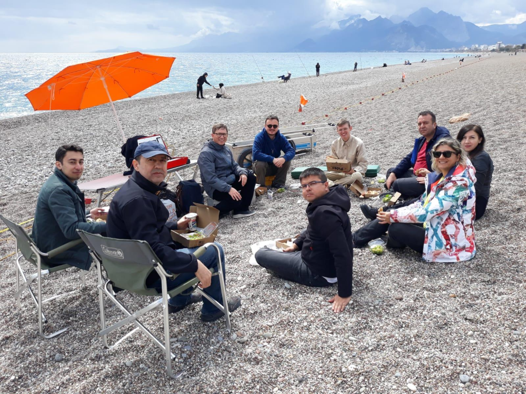
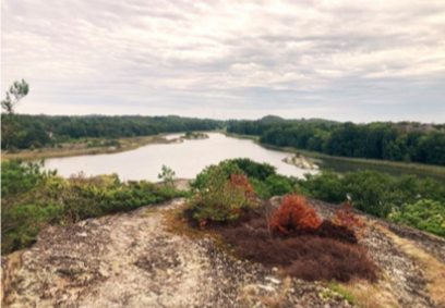
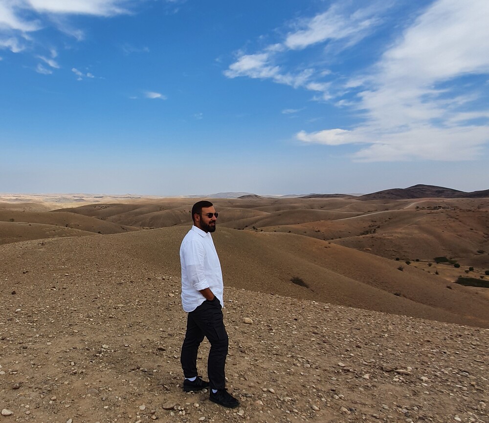
Turkish colleagues during the field campaign.
A joint manuscript with the İstanbul Technical University and the University of Kocaeli about the onshore-offshore connection of the aquifer in Antalya is in preparation with the title: “Hydrogeophysical investigations in the coastal regions of Antalya: An offshore – onshore approach” to be submitted to Hydrology and Earth System Sciences. The outcome of this STSM was additionally presented at the European Geoscience Union generally assembly in Vienna in April 2024 with the title: “Assessing freshwater plumes, offshore freshened groundwater and the risk of salt intrusions in urbanised karstic groundwater systems using combined resistivity methods”.


Home Institution: University of Malta
Host Institution: Ruden AS, Oslo
Duration of stay(days): 9
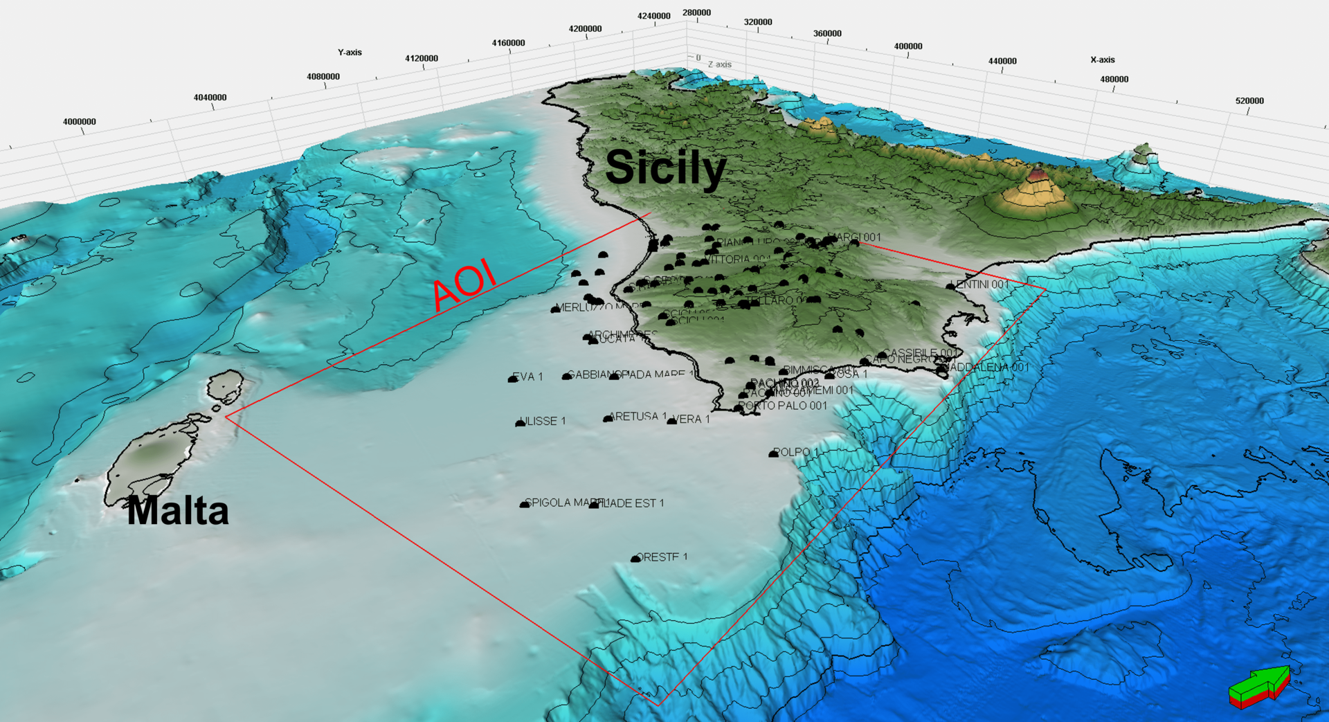
Objectives: The aim of the visit is to implement a robust quantitative use of geophysical logs from deep Oil&Gas wells drilled in the southern offshore of Sicily (Italy), to estimate and/or extract groundwater salinity information as the base for a groundwater 3D salinity hydrogeological model. In particular, few key qualitative indications of fresh/brackish groundwater presence have been detected in the Oligo-Miocene ramp carbonate reservoir of the Ragusa Formation, based on a quick-look at composite logs, both in the onshore and in offshore of southern Sicily. The STSM objectives can be reached with the proposed visit to Ruden’s team, which has developed a specific and proven workflow on this topic (quantitative use of logs) and will be able to assist and support such a quantitative step.
Summary of the work: During the STSM in Oslo, c/o Ruden AS company, a workflow for the quantitative use of geophysical logs from deep Oil&Gas wells in southern Sicily (Italy) was implemented and carried out, with the final objective of estimating groundwater salinity information. The work was focused on the Oligo-Miocene interval of the Ragusa Formation, a medium-high porosity carbonate reservoir deposited in a ramp environment, outcropping over the Hyblean plateau in southern Sicily. The following steps were carried out: i) identification of 5 key wells in the area of interest (1 offshore and 4 onshore southern Sicily); ii) digitization of the full suite of logs required for the application of petrophysical workflow, such as SP (Spontaneous Potential), GR (Gamma Ray), DT (Sonic log) and Resistivity logs; iii) construction of a synthetic lithological log for each selected well, needed to characterize the lithological influence of electrical logs; iv) application of a customised petrophysical workflow for porosity and salinity estimation (concentration of salts in TDS), considering: lithotypes, BHT (borehole temperatures), porosity (derived to DT – sonic log), pore fluid resistivity; v) comparison of TDS results with salinity data from DST and composite logs; vi) well correlation and well salinity cross-section. All the five selected wells have been completed and fully analysed, in terms of logs digitalization and logs interpretation, for their whole drilled thickness.
The main outcome has been to quantitatively demonstrate, for the first time, the presence of fresh groundwater in the offshore of southern Sicily (Italy), within the Ragusa Fm. reservoir, through the use of digital logs and petrophysical concepts.
At the same time, the work done suggests that this deep aquifer appears likely connected with the onshore aquifer.
The work has also been a very good opportunity to exchange ideas, knowledge and reinforce the collaboration with colleagues from the host institution.
Home Institution: The Academy of Technical Applied Studies, Belgrade
Host Institution: Stockholm University
Duration of stay(days): 14
Objectives: The objective of this Short-Term Scientific Mission (STSM) is to conduct a comprehensive analysis of the groundwater transmissivity from the Svalbard fjords. This involves examining the chemical and physical characteristics of soil/sediment cores recovered from Svalbard to gain a deeper understanding of offshore freshened groundwater (OFG) present in them. This research is important for advancing our knowledge of OFG bodies and addressing water management necessities in coastal regions. Working collaboratively with the Department of Geological Sciences at Stockholm University, the collected cores will undergo thorough testing utilising all available laboratory scanners, including X-ray, XRF, and MSCL, to ensure a detailed and accurate assessment.
Summary of the work:
At the beginning of August of this year, I had the opportunity to go to Stockholm, Sweden on a Short-Term Scientific Mission (STSM) through the COST Action OFF-SOURCE. My host and mentor on this mission was Professor Wei-Li Hong from the Department of Geological Sciences, University of Stockholm, who played an integral role in steering the fulfilled endeavours.
During the span of the two-week STSM, an evaluation of the physical and mechanical attributes of soil and sediment cores obtained from Svalbard was meticulously conducted. These cores were subjected to measurements, analysis, and processing in accordance with the predefined work plan, taking into account practical constraints and the available time frame.
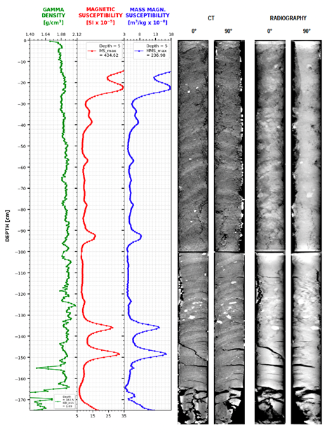
The project began in the laboratories of the Department of Geological Sciences. The first phase involved conducting analyses on the physical and mechanical attributes of three core samples extracted from Svalbard fjord sediments, employing the Multi-Sensor Core Logger (MSCL). The cores were examined in a whole state, and the properties assessed encompassed gamma density, p-wave velocity, magnetic susceptibility, and electrical resistivity. These analyses yielded datasets that were carefully audited and subsequently processed to facilitate their utilisation and effective portrayal of the core’s physical and mechanical characteristics.
Subsequently, a further examination of the cores transpired through the application of a Rotating X-ray CT system (RXCT). This procedure generated radiographic and CT images of the samples. The next step was to refine and enhance these images, ensuring they accurately portrayed the authentic nature of the core samples. This was accomplished with the Geotek software, which provides the capabilities for visualisation, acquisition, and processing of these images.
When put together, the data obtained from RXCT and MSCL contributed to a better comprehension of the internal structures within the core samples. In light of this, visual representations in the form of plots for MSCL measurements encompassing gamma density, magnetic susceptibility, and mass magnetic susceptibility were juxtaposed with the meticulously processed radiographic and CT images. This juxtaposition facilitated a more holistic interpretation of the core’s physical attributes.
Although time constraints prevented examinations of split cores during this mission, future collaborative efforts will enable additional non-destructive analyses such as XRF core scanning and discrete sampling. These advanced analyses will provide deeper insights into groundwater transmissivity within the fjords of Svalbard. Furthermore, the prospect of formulating numerical models and cultivating collaborations among the members of the COST Action network holds promise for future projects within the overarching framework of the COST Action.
The analyses conducted on three core samples from Svalbard fjord sediments and the resulting datasets contribute to the broader effort of compiling a comprehensive database of known Offshore Freshened Groundwater (OFG) bodies. This initiative aims to consolidate existing geological and geophysical data from various sources, including published literature and specialised data sets, thus enhancing our understanding of OFG characteristics in European waters.

Home Institution: University of Roma Tre
Host Institution: Université de Montpellier
Duration of stay (days): 10
Objectives: The aim is to define a methodology for the analysis of deep wells (in particular offshore) to investigate the characteristics of deep groundwater. The main objective will be to define a detailed workflow based on the multidisciplinary analysis of well Composite Logs (complete summary of all operations carried out during drilling) using fluid tests, and electrical logs to define the presence of deep groundwater through the estimation of pore water conductivity.
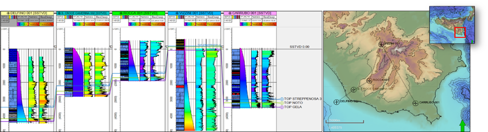
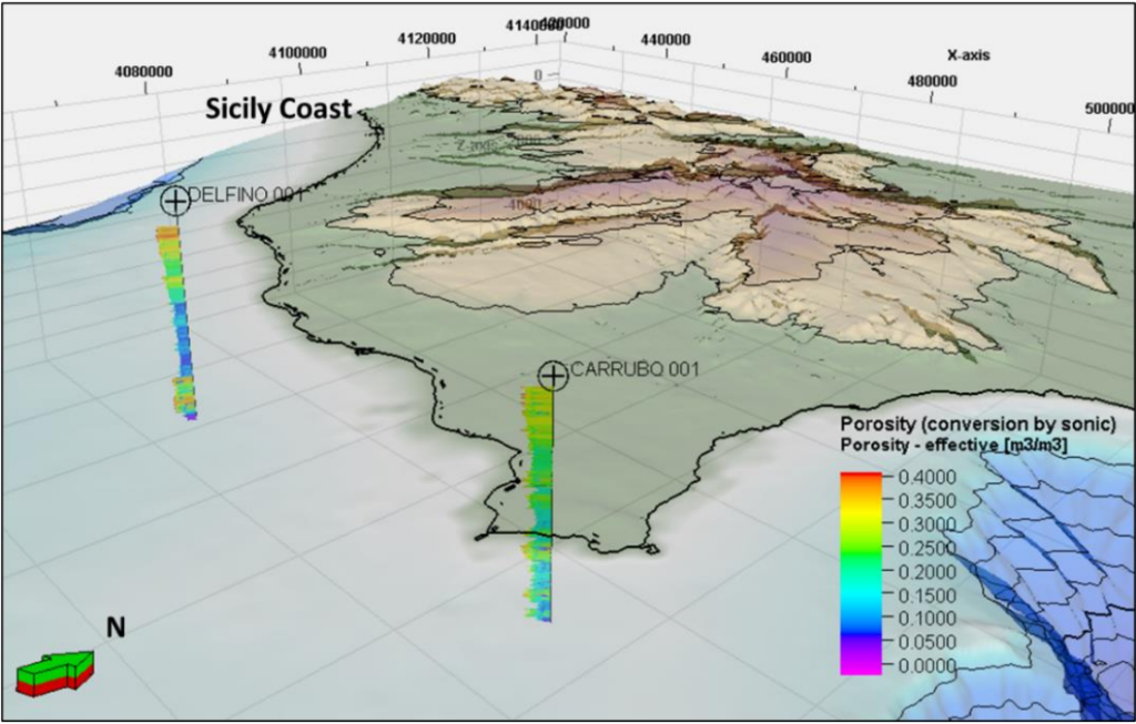
Summary of the work: During this STSM, the objective was to define a methodology for the analysis of deep wells to identify deep groundwater and define their characteristics. A detailed workflow was defined based on multidisciplinary analysis of well Composite Logs (complete summary of all operations performed during drilling) using fluid tests (DSTs and production test). Production tests and DSTs are measurements that are carried out in the wells under production conditions, to determine the nature of the fluid present and the production capacity of the mineralized formations. Through these, it is possible to extract salinity and pressure information. The workflow was defined according to the following steps: i) choose an area with good data availability in terms of deep wells (the Hyblean Plateau and its adjacent offshore); ii) within the study area, two key wells were chosen, one onshore (Carrubo 1) and one offshore (Delfino 1); iii) data were extracted directly from the intervals that have been tested by DST’s or Production test (salinity data of the recovered fluid; pressures of the formation fluid; volume quantities of the fluid recovered during the test; the times of duration of the test). Then, in addition to the planned work, a comparison was also made between the fluid test method results and the pore water conductivity method applied on well logs. The electrical logs of the wells surveyed were digitised for a total of about 24 km of digitised logs. Then porosity was derived by converting the Sonic log and conductivity was calculated from resistivity using Waxman and Smith’s 1968 law, based on Archie’s law of 1942. Finally, pore water conductivity was calculated along the profiles of the chosen wells.
Home Institution: Marine Geology Seafloor Surveying Msida
Host Institution: The MarCoast Ecosystems Integration Lab, at the Technion — Israel Institute of Technology
Duration of stay(days): 15
Objectives: The primary goal of this STSM is to collect and prepare data that will be utilized to assess the Offshore Freshened Groundwater (OFG) potential on the Israeli continental shelf. The expected technical outputs include a data repository including seismic and other geophysical data, geological cross-sections, borehole and water quality data, a summary of the depositional environment of the Israeli continental shelf and its implications for the potential reservoir distribution, and a definition of model domain for subsequent 3D numerical shelf modelling of groundwater salinity distribution on the continental shelf.
Summary of the work:
The main objective of this visit was to identify and search local data sources/repositories and collect relevant data for investigation of OFG potential on the Israeli continental shelf. This was done by consulting various researchers at the host institute to identify data sources. A key resource was the Petroleum Repository of the Israeli Ministry of Energy, which hosts data and information on E&P activity for oil and gas onshore and offshore Israel. The STSM also included a site visit to the Geological Survey of Israel in Jerusalem, facilitated by Dr. Yael Sagy.
Finally, a seminar talk was presented at the Grand Water Institute titled, “Offshore Freshened Groundwater: An unconventional water resource in coastal regions?” The seminar series of the Grand Water Institute was attended by approx. 30 engineers and researchers from the Technion. The talk highlighted the state of the art of OFG research and presented a number of case studies.
As technical outputs of this STSM, there will be:
- A data repository including seismic and other geophysical data, geological cross-sections, borehole and water quality data. It includes digital elevation, bathymetry and surface data, borehole data and other GIS data (polygons) describing the project area.
- A literature review of past geological studies and coastal groundwater studies as well as a summary of the depositional environment of the Israeli continental shelf and its implications for the potential reservoir distribution.
- Definition of the model domain for subsequent 3D numerical shelf modelling of groundwater salinity distribution on the continental shelf was well defined.
As follow-up of my mission, I plan to digitise the legacy borehole data and run a geostatical modelling exercise of the coast aquifer properties; gather shallow borehole data from groundwater wells to help constrain onshore properties of the shallow sediments; reconstruct the paleo-hydrological sealevel history on the coastal aquifer model and investigate OFG potential (Work planned in the scope of follow-up STSM by Daniel Zamrsky); and present the study results at Sea Water Intrusion Meeting in En Gedi, Israel in January 2024.
Home Institution: University of Roma Tre
Host Institution: University of Malta
Duration of stay (days): 16
Objectives: The main objective of this STSM would be to generate a 3D model of the carbonates of the Gela platform as a possible reservoir of fresh groundwater. The main goals of the STSM are 1) to work on deep well data from South-Eastern Sicily (focus on Gela Carbonate Platform), 2) to analyze Composite Logs and associated data (formation top, stratigraphy, facies, Electrical Logs, etc..), and 3) to assess whether the Gela platform is a possible reservoir of fresh groundwater.
Summary of the work: The target of this STSM has been the Gela Formation (located in the South-East of Sicily), a Triassic carbonate platform of shallow-water facies. As a result of Oil & Gas exploration in this area, several well Composite Logs and associated drilling reports are publicly available. The analysis of 10 chosen deep wells’ data led to an organised database with several elements (formational tops, thicknesses, stratigraphic facies, geographic position, value of ground level, and total drilling depth) ready to be used for a modelisation in the Petrel software. This allowed to build, over the whole area of interest, the Top and Base Gela Formation structural surfaces. These surfaces were further used, with stratigraphic layering, as the foundation for the construction of the preliminary 3D geometrical model.